After a tough night of disturbed sleep because we were eaten alive by mosquitoes, it was time to get up, and get revenge. We dispatched about 50 of them, leaving a bloody trail from one one of the camper to the other. We will have to scout out the trailer and figure where we have a breach in our defences.
It was time to get out of dodge, and hit the road. Unfortunately, our early departure from Bunnell Campground was soon lost because we crossed into Eastern Standard Time. We lost an hour out of our travel day.

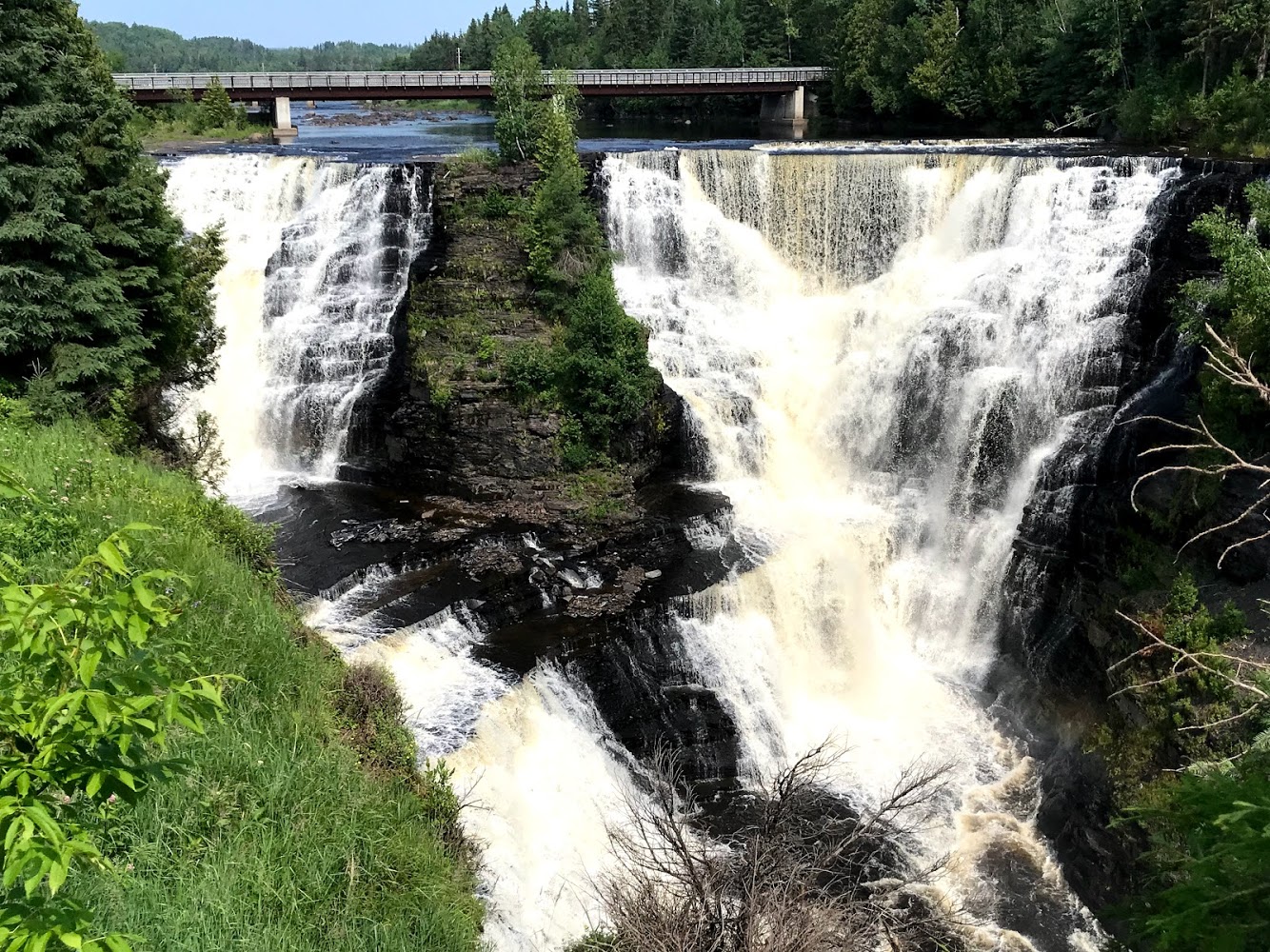
Our first stop was Kakabeaka Falls Provincial Park. The falls have a drop of 40 m (130 ft), cascading into a gorge carved out of the Precambrian Shield by meltwater following the last glacial maximum.
Because of its size and ease of access, it has been consequently nicknamed “the Niagara of the North”.

The rock face of the falls and the escarpments along the gorge are composed primarily of unstable shale, and are eroding. These rocks contain some of the oldest fossils in existence, some 1.6 billion years of age.

After Kakabeka Falls, we headed to Mount McKay, which is a maficsill located south of Thunder Bay. It is the highest, most northern and best known of the Nor’Wester Mountains. It formed during a period of magmatic activity associated with the large Midcontinent Rift System about 1,100 million years ago.

We watched First Nation Youth building a birch bark canoe, using materials they had gathered from the local forests.

We left Mount McKay, and continued east along Highway 17, within a few kilometres, we stopped at the Terry Fox Memorial and Lookout.

A nine foot high bronze statue, set on a 45-ton granite base with a foundation of local amethyst, commands a breath-taking view of Lake Superior. The statue was erected in memory of Terry Fox, the courageous one-legged runner who embarked on a cross-country run for cancer research – the Marathon of Hope. The site is not far from the place where he ended his 5,342 km (3,339 mi) run, stricken with the disease that ended his life on June 28, 1981.

We arrived at Rainbow Provincial Park, Rossport Campground which is located on the shoreline of Lake Superior.

Lake Superior has a surface area of 82,103 km2 which is approximately the size of South Carolina or Austria. It has a maximum length of 560 km and maximum breadth 257 km. Its average depth is 147 m with a maximum depth of 406 m. Lake Superior contains 12,100 km³ of water. There is enough water in Lake Superior to cover the entire land mass of North and South America to a depth of 30 centimetres. The shoreline of the lake stretches 4,387 km (including islands).

The sun dipped below the horizon, casting a golden hue on another amazing day of our adventure,

